REVIEW · SEDONA
Ancient Sedona (30+ Mile) – Sedona Helicopter Tour
Book on Viator →Operated by Apex Air Tours · Bookable on Viator
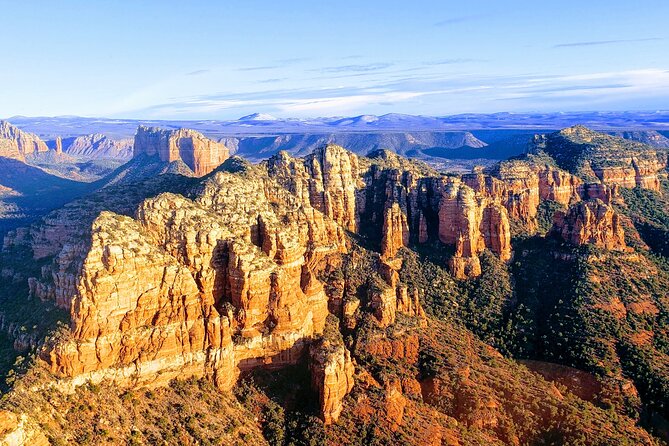
Sedona looks different from the sky. This Ancient Sedona helicopter ride covers about 30 miles, turning a quick hop into a stacked tour of red-rock icons like Cathedral Rock and the canyon country around Sedona. You also get a rare aerial angle on Sinagua ruins, which you normally have to study on the ground.
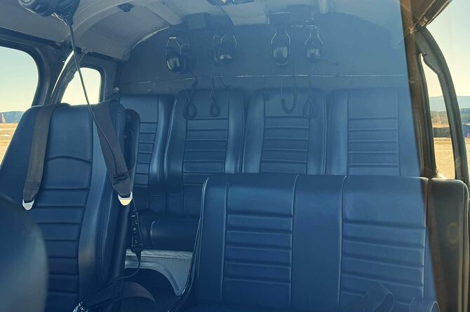
I love that the helicopter has all-forward seating, so you don’t end up stuck staring at a side wall while everyone else gets the views. I also like the noise-reducing headset with microphone, because it makes the pilot’s commentary actually usable, not just background noise.
The main consideration is simple: this is weather-dependent and shorter than it sounds. You’ll need good conditions, and there’s a 269 lbs per-passenger weight limit, plus the instruction not to fly if you are sick.
In This Review
- Key things that make this helicopter ride worth your time
- A 20–22 Minute Flight That Packs a Lot of Sedona
- Seats, headsets, and getting comfortable fast at the airport
- Takeoff views and the quick way to get your bearings
- From Red Rock State Park to Cathedral Rock at eye level
- Bell Rock, Broken Arrow Trail, and the aerial landmark hunt
- Midgley Bridge and Oak Creek Canyon: seeing the waterways from above
- Sinagua ruins in Boynton and Long Canyon
- Natural bridges, golf-course flybys, and the 3-fingers moment
- Price and value: is $306.48 worth 20–22 minutes?
- Who should book this, and who should skip it
- Should you book Ancient Sedona with Apex Air Tours?
- FAQ
- How long is the Sedona helicopter tour?
- Where is the meeting point, and does it return there?
- What seating setup is used on the helicopter?
- What’s included with the ride?
- How many people are on the helicopter?
- Is there a cancellation option if weather is bad or plans change?
Key things that make this helicopter ride worth your time
- All-forward seating means you’re positioned for views throughout the entire flight
- Noise-reducing headset with mic helps you catch pilot explanations mid-flight
- 30 miles of route covers a lot of Sedona icons in just 20–22 minutes
- A maximum of 6 travelers keeps the experience feeling personal in the aircraft
- Eye-level moments put formations like Cathedral Rock in true “right there” perspective
A 20–22 Minute Flight That Packs a Lot of Sedona
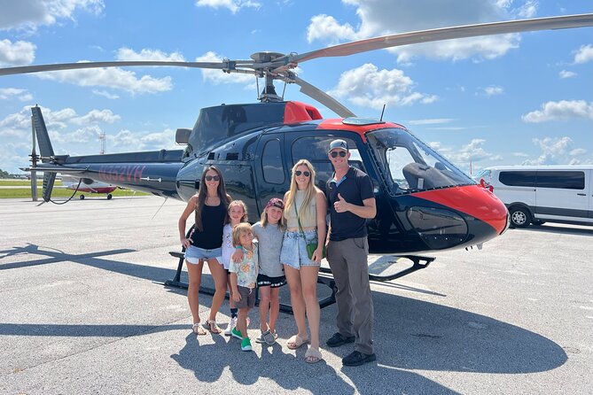
A Sedona helicopter tour sounds like a luxury splurge until you realize what you’re actually buying: perspective. From the ground, Sedona’s rock towers and canyon cuts are impressive. From the air, they become part of a bigger map, where formations relate to each other like landmarks on a trail system.
This ride runs about 20 to 22 minutes and is built as a loop-style route, so you get takeoff, viewpoint flybys, and return without long transfers or waiting around. The tour also targets a lot of the “most asked about” sites people want to see, including cathedral-style rock shapes, chapel views, and canyon mileage that would take you all day by car and foot.
The other big win is pacing. You’re not spending half your time driving to viewpoints you’ll only glance at. Instead, the helicopter strings the best angles together, including some deep and remote canyon sections that are hard to access casually from the road.
Seats, headsets, and getting comfortable fast at the airport
The meeting point is 1225 Airport Rd, Sedona, AZ 86336, and the tour ends back there. That matters because Sedona traffic and parking can be a hassle, especially in peak season. Here, you’re moving quickly from ground logistics into the flight portion.
Once you’re in, you’ll appreciate the setup: all forward facing seating and an air-conditioned vehicle as part of the experience flow. Forward-facing seating is more than a perk. It changes the whole vibe. In many short helicopter flights, it’s easy to feel like you’re sharing the views with half the group. This arrangement helps everyone see.
You’ll also wear a noise reducing headset with microphone. Helicopters are loud. This is one of those “small tech detail, big practical difference” things. If the headset works the way it’s intended, you get the benefit of what the pilot is saying instead of just enjoying silence and noise.
On the human side, the pilot experience seems to be a highlight. People mention pilots like Jeff and Joshua as friendly and easygoing while also explaining what you’re seeing. That’s the sweet spot for a short ride: you don’t want a lecture, but you do want the context.
One more note: the tour has a maximum of 6 travelers, which is a real factor for comfort and vibe. A smaller group tends to feel less rushed, and you’re more likely to get the kind of calm, organized attention you want before liftoff.
Takeoff views and the quick way to get your bearings
The ride begins with an overlook as you take off and land from the airport. Even that moment helps. Sedona can look chaotic on a map until you see how the terrain rises and breaks. That first aerial glimpse helps your brain lock onto directions—so later, when you’re flying past formations, they feel like landmarks instead of random rocks.
From there, the route immediately starts stacking recognizable terrain. You fly by Red Rock State Park, which is a good early clue that you’re moving beyond just the busiest postcard spots. Even if you’ve driven through Sedona before, the state park area gives you a sense of how broad the red-rock geology is.
The next section is built for wow-factor, but in a controlled way. You’re not just passing over famous names. You’re being positioned for the shapes people talk about, including the ones that look different at different angles from the air.
From Red Rock State Park to Cathedral Rock at eye level
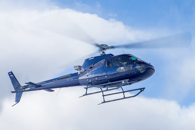
If you’re wondering what a helicopter does that a viewpoint can’t, this is where you feel it. You get a fly-by eye-level with the top of Cathedral Rock. That line matters. “Near” in the sky is very different from “far away on a scenic drive.”
From the ground, Cathedral Rock is tall and dramatic, but you often see it framed by roads, trees, and distance. From the air, the top portion becomes part of the route. You can track it as a structure rather than an image on a sign.
After that, the tour routes toward views of the Chapel of the Holy Cross. In Sedona, this chapel is iconic because it sits in a dramatic setting. Up high, you can see not just the building but the relationship between it, the surrounding rock, and the canyon terrain. It turns the chapel from a destination into a point on a larger landscape grid.
Then you’ll fly by Bell Rock, another formation that’s easy to recognize from the ground. A helicopter makes it feel closer to a sculpture you could circle—because you’re effectively circling it, just from above.
Bell Rock, Broken Arrow Trail, and the aerial landmark hunt
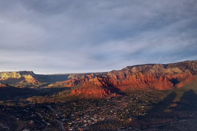
This tour leans hard into the idea of “name recognition.” You’ll pass key points tied to the area’s hiking and photo spots, and the helicopter adds a missing ingredient: the route connections.
You’ll fly over the Broken Arrow Trail, including distinct features like the Praying Hands, Chicken Point, and Submarine Rock. From the ground, these are famous shapes you look for on the trail. From the air, they become markers you can place relative to surrounding canyon lines and ridges. That helps if you’re the type who later wants to understand how the hike fits into the geography.
Next comes Courthouse Butte, another landmark that looks like a silhouette from many angles on the road. Flying past from above gives you a clearer read on its mass and the way adjacent formations relate to it.
Then the tour keeps going with a run of recognizable smaller formations: Snoopy Rock, the Tea Kettle, Eagle Rock, and the Cowpies. If you love photography or you just like spotting things quickly, this portion hits. You get a chain of “I know that one” moments, and the aerial angle makes them feel fresh instead of repetitive.
One practical upside: on a longer land tour, you’d be stopping, walking, and scanning for viewpoints. Here, you’re seeing all the key angles in one continuous movement. It’s a different kind of satisfaction, and it works well for time-starved trips.
Midgley Bridge and Oak Creek Canyon: seeing the waterways from above
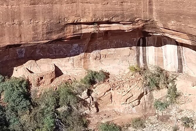
Not every Sedona helicopter route gives you enough canyon context. This one does. You’ll see Midgely Bridge from the air, then shift toward Steamboat Rock, Ship Rock, and Oak Creek Canyon.
Oak Creek Canyon is where Sedona starts to feel less like a collection of towers and more like a corridor. From the helicopter, you can follow the canyon lines and understand why the roads snake the way they do. It’s the kind of view that makes you realize how the terrain controls everything.
As you continue, you’ll also get the mouth of Oak Creek Canyon. That phrase sounds simple, but from the air it helps you understand how canyon drainage funnels and where the big rock walls open up. It’s the difference between looking at a single viewpoint and understanding the full system.
Then the route highlights a canyon full of rock pillars and seasonal waterfalls, plus aerial views of Ship Rock and the Fin. “Seasonal waterfalls” is key. You might catch water flowing depending on conditions when you go, but even without water, pillar formations and canyon cut lines still show well from above.
This is also a good point in the flight to think about what you’re learning. If you’re planning future hiking or a self-drive day, aerial views help you pick routes intelligently because you’ll recognize the geometry from the air later.
Sinagua ruins in Boynton and Long Canyon
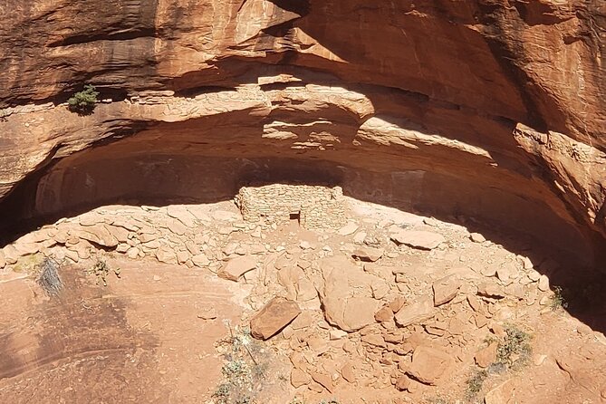
Here’s the cultural angle of the ride, and it’s not just a side note. You’ll fly through Secret Canyon past Secret Mountain, and then you’ll head into Boynton Canyon and Long Canyon where you can see ancient ruins from the air.
The tour summary specifically mentions Sinagua ruins, and these canyon sections are exactly where that aerial perspective can be valuable. Many ruins are hard to appreciate from a distance on the ground, especially if you’re not on the right trail segment. From above, you can spot ruin settings as part of the surrounding canyon and rock shelter terrain.
From a traveler’s standpoint, this matters because it adds a second layer to the trip. You’re not just collecting photos of red rocks. You’re seeing how people used these canyon spaces long ago, even if you’re only getting a flying survey view rather than a slow walk and a long explanation.
Also, the route through these areas keeps the ride from feeling like only “big name rocks.” You get variety: tight canyon corridors, hidden-feeling passages, and then back toward the more famous formations people want on their first visit.
Natural bridges, golf-course flybys, and the 3-fingers moment
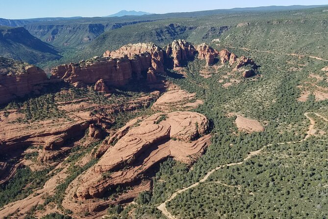
Sedona loves shapes, and the route here keeps delivering them. You’ll see a natural bridge from the air, described as one of the area’s most popular hikes. Even if you know the trail already, viewing a natural bridge from above helps you understand the bridge’s span and how the rock layers sit beneath it.
You’ll also fly by Coffee Pot Rock, Soldiers Pass, the Mitten, and Sphinx Rock. This is another stretch of “signature shapes.” A helicopter makes these stand out because you’re not stuck with one sightline. You can see how the shapes shift with perspective as the aircraft moves.
The route includes Seven Canyons golf course from above, which is one of those odd-but-fun inclusions. It gives you a reference point for scale. You can see how the built areas fit into the canyon system, and it helps you place where Sedona’s development sits against the geology.
Then comes the tail end of the route into more canyon magic and classic silhouettes. You’ll fly through Secret Canyon again in the broader flow, then through Boynton Canyon and Long Canyon as mentioned, and later fly past Doe Mountain and Mescal Mesa.
The final big visual beat is Chimney Rock turning into the 3 fingers as the perspective changes. This is one of those Sedona moments where you can see how “the same rock” becomes a whole story when you view it from the right angle. From the ground, you might miss that transformation. From the air, it’s more like a reveal.
On the way back, you’ll also fly over Schuerman Mountain before returning to the airport. That wrap-up makes the whole loop feel connected instead of like a series of disconnected flybys.
Price and value: is $306.48 worth 20–22 minutes?
At $306.48 per person, this isn’t a budget activity. But you’re not paying just for the ride time. You’re paying for a high-value way to compress a huge chunk of Sedona into a short window.
Here’s how I think about the value:
You’re getting all-forward seating, which improves the quality of every second. A short helicopter ride is expensive when you’re stuck without views. This setup reduces that risk.
You’re also covering about 30 miles and hitting major formations, canyon zones, and even aerial views of Sinagua ruins. By car, you’d spend a lot of time hopping between sites, parking, and hoping you can see the formation from the right angle. A helicopter solves that by design.
Add in the headset and the pilot explanations, and the flight becomes more than just a thrill. It turns into a quick crash course in how Sedona’s landmarks fit together.
Finally, the ride is capped at 6 travelers. That small-group feel is part of the pricing equation too. You’re not in a packed herd.
If you’re on a tight schedule and you want a “wow” activity that also helps you understand where to drive and hike next, I’d say the cost can make sense. If you’re hoping for a long, guided walking tour, you’ll likely feel the time limit more than the price tag.
Who should book this, and who should skip it
This experience fits best if you want:
- A fast, high-impact view of multiple Sedona icons
- A chance to see formations from above without spending the whole day driving
- An aerial look that can help you plan future hikes with better context
It’s also a good choice if you prefer smaller groups. With a maximum of 6 travelers, it tends to feel more personal than the big-group tours.
You’ll want to consider skipping (or rescheduling) if:
- You’re sick, since the guidance is do not fly if you are sick
- You don’t have flexibility for weather, because good weather is required
- You’re near the 269 lbs weight limit, since the total per passenger weight matters
One more practical tip: plan ahead. The tour is often booked around 16 days in advance on average. If you’re traveling in a busy season or on a specific date, waiting until the last minute can squeeze your options.
Should you book Ancient Sedona with Apex Air Tours?
If you’re choosing one “Sedona big view” activity and you want maximum satisfaction per hour, this is a strong candidate. The combination of all-forward seating, a smooth flight format, and the kind of pilot commentary that keeps the ride understandable makes the short duration feel intentional rather than cut short.
I’d book it if you love iconic rock formations and you want the helicopter perspective for things like Cathedral Rock, Bell Rock, and the canyon network around Oak Creek. I’d also book it if the idea of aerial views of Sinagua ruins appeals to you.
I’d hesitate if you’re prone to motion or you’re sensitive to weather changes, or if you expected something that feels like a long, slow tour. This is a quick aerial circuit. The payoff is in how many landmarks you can see in one go.
FAQ
How long is the Sedona helicopter tour?
The flight duration is approximately 20 to 22 minutes.
Where is the meeting point, and does it return there?
You meet at 1225 Airport Rd, Sedona, AZ 86336, and the activity ends back at the meeting point.
What seating setup is used on the helicopter?
The tour includes all forward facing seating.
What’s included with the ride?
You get a noise reducing headset with microphone and an air-conditioned vehicle as part of the experience.
How many people are on the helicopter?
The tour has a maximum of 6 travelers.
Is there a cancellation option if weather is bad or plans change?
Yes. You can cancel for a full refund up to 24 hours in advance. The experience also requires good weather, and if it’s canceled due to poor weather, you’ll be offered a different date or a full refund.